RailTrailWx logoRailTrailWx
ForecastExploreLogbookProfilesAboutPricingUpdatesFAQPrivacyTermsYouTube

© 2026 Entrain Weather, LLC. RailTrailWxᵀᴹ and the Entrain Weather Microclimate Engineᵀᴹ are services of Entrain Weather, LLC.

Back to Trail Explorer

Marvin Gaye Trail

Marvin Gaye Trail, District of Columbia, DC, 1.88 miles

Trail Facts

Length 1.9 mi
Elevation 35 to 72 ft
Grade 0.4% average
Shade cover 45%
Surface Asphalt

Activities

E-biking · Biking · Walking · Running · Birding · and more

About This Trail

The Marvin Gaye Trail is a paved path of about 1.9 miles through Marvin Gaye Park in Ward 7 of Northeast Washington. It follows Watts Branch upstream from Lady Bird Johnson Meadows at Minnesota Avenue NE to the Marvin Gaye Recreation Center at 61st Street NE. Along the way it passes 44th, 49th, and 55th Streets NE and reaches Heritage Green at Division Avenue and Foote Street, the park's community stage and plaza. The path stays close to the stream under a partial canopy of oaks, elms, and hackberries. The grade is nearly flat, rising gently toward the east end. It is not a rail trail, and it has no off-street link to the Anacostia River Trail.

RailTrailWx TIPS

Marvin Gaye Trail

Your comfort. Prognosticated.

  • The trail climbs gently and steadily upstream along Watts Branch, so heading east toward the recreation center is the slightly uphill direction, though the whole rise is only about 40 feet.
  • The path runs mostly west-northwest to east-southeast along the stream, so a west or northwest wind is a tailwind toward 61st Street and a headwind on the way back.
  • Shade is decent across most of the trail, with bountiful park trees to find shade under on a sunny day.

-Cory

Trivia

  • Watts Branch rises near Capitol Heights in Prince George's County, Maryland, and flows roughly northwest for about 4.9 miles to the Anacostia. It is the largest tributary of the Anacostia River within the District of Columbia.
  • Marvin Gaye Park is Washington's longest municipal park. It was rededicated on April 2, 2006, which would have been Marvin Gaye's 67th birthday.
  • In 2018, Casey Trees, Washington Parks and People, and the DC Department of Parks and Recreation planted more than 55 trees through the park and along the trail, including American hornbeams and hackberries.
  • Over three weekends in July 2017, Student Conservation Association crews measured every tree in the park.
  • The $14 million Marvin Gaye Recreation Center, opened in 2018, has a music room, a teaching kitchen, and an art gallery space.

Climate

Excellent biking days per month, 2011-2025 climatology

In a typical year the Marvin Gaye Trail has about 115 to 161 days of excellent weather for popular activities such as hiking, dog walking, e-biking, birding, running, biking, and walking, with April, October, and November the best months.
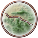
Marvin Gaye Trail medallion

RailTrailWx Comfort Scores, for your activity.

Hourly comfort scores for the next 15 days of weather, tuned to your activity and your own thresholds.

Plan your visit to this trail. Get the best windows for a comfortable outing.

View the forecast

Enjoy the Marvin Gaye Trail!

Peak Fall Color Climatology

Calendar of the typical peak fall color window along this trail

In half of past years, color along the Marvin Gaye Trail peaks November 5 to 13, typically around November 9. The trail has 24% deciduous coverage, with the majority being yellow-poplar, sweetgum, white oak, and American beech.

History

No railroad ever ran here. This corridor belongs to Watts Branch, the largest tributary of the Anacostia River inside the District. Around the 1870s, planners began turning the farmland along the stream into a suburb. The stream valley became Watts Branch Park. In 1966, First Lady Lady Bird Johnson's beautification campaign set out to refurbish it. In 1970, federal maintenance money ended and the city took over upkeep. The park slid into neglect. In 2001, Washington Parks and People began a volunteer cleanup. Neighbors kept at it for five years. On April 2, 2006, the city rededicated the valley as Marvin Gaye Park, on what would have been the singer's 67th birthday. The city then rebuilt two anchors of the park. Lady Bird Johnson Meadows holds the western end. Heritage Green, at Division Avenue and Foote Street, gained a community stage, a playground, and a plaza. The same work completed a bicycle trail through the whole park. Crews also stabilized the eroding stream banks, fixed sewer lines, and planted trees. In December 2016, Mayor Muriel Bowser broke ground on a new recreation center at the eastern end. The $14 million Marvin Gaye Recreation Center opened on May 5, 2018, with improvements along the trail.

Trailheads

  • Lady Bird Johnson MeadowsMILE 0Directions
  • 44th Street NEMILE 0.3Directions
  • 49th Street NEMILE 0.8Directions
  • Division Avenue NEMILE 1.1Directions
  • 55th Street NEMILE 1.4Directions
  • Marvin Gaye Recreation CenterMILE 1.9Directions

Connects To

None

Managed By

DC Department of Parks and Recreation

Further Reading

  • Office of the Mayor of the District of Columbia · Mayor Bowser Breaks Ground on Marvin Gaye Recreation Center in Ward 7
  • Office of the Mayor of the District of Columbia · Mayor Bowser Celebrates Marvin Gaye Day with Ribbon Cutting of Marvin Gaye Recreation Center
  • Chesapeake Bay Program · As an Anacostia tributary is restored, D.C. residents reap the benefits
  • Clio · Marvin Gaye Park
  • Casey Trees · Black History Month: Marvin Gaye Park
  • DC Office of the Deputy Mayor for Planning and Economic Development · Marvin Gaye Park
  • Wikipedia · Watts Branch (Anacostia River tributary)

Nearby trails

Anacostia River Trail medallion

Anacostia River Trail

10 mi·DC, MD
ExploreForecast
Metropolitan Branch Trail medallion

Metropolitan Branch Trail

5.9 mi·DC
ExploreForecast
Rhode Island Avenue Trolley Trail medallion

Rhode Island Avenue Trolley Trail

3.9 mi·MD
ExploreForecast