RailTrailWx logoRailTrailWx
ForecastExploreLogbookProfilesAboutPricingUpdatesFAQPrivacyTermsYouTube

© 2026 Entrain Weather, LLC. RailTrailWxᵀᴹ and the Entrain Weather Microclimate Engineᵀᴹ are services of Entrain Weather, LLC.

Back to Trail Explorer

Anacostia River Trail

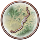
Anacostia River Trail, District of Columbia, Prince George's Counties, DC, MD, 10.12 miles

Trail Facts

Length 10 mi
Elevation 6 to 20 ft
Grade 0.1% average
Shade cover 29%
Primary surface Asphalt
Secondary surface Boardwalk, Concrete

Activities

E-biking · Biking · Walking · Running · Birding · Fishing · Kayaking · and more

About This Trail

The Anacostia River Trail follows the tidal Anacostia River for about 10 miles, from Hyattsville and Bladensburg in Maryland to the Navy Yard in Washington. The whole route is paved and essentially flat. North of Benning Road it threads forest, fields, and marsh past Kenilworth Aquatic Gardens, where a boardwalk reaches out over some of the last original tidal wetlands in the capital. Farther south it runs through Anacostia Park, where the trail system uses both banks and links to bridges across the river. Herons, egrets, osprey, and bald eagles are regular sights. At the north end it meets the Anacostia Tributary Trail System at Bladensburg Waterfront Park.

RailTrailWx TIPS

Anacostia River Trail

Your comfort. Prognosticated.

  • The trail is dead flat from end to end and sits only a few feet above the tidal river, so the wind, not any hill, decides how hard the trip feels.
  • The trail runs roughly north to south along the river, so a north wind pushes you toward the Navy Yard and a south wind is in your face on the way there.
  • More than half the route is open to the sky, with only scattered tree cover, so expect full sun at midday and little shelter from wind blowing across the river.
  • The marsh at Kenilworth rises and falls two to three feet with the tide, so the boardwalk view and the wading birds change from hour to hour.
  • Bladensburg Waterfront Park makes a good base at the north end, with a pavilion, a fishing pier, and kayak and canoe launches right on the river.
  • You can reach this trail easily from farther north in Maryland via the Northeast or Northwest Branch Trails.
  • Toward the Navy Yard, the trail becomes busy with pedestrians. If you are biking, feel free to hop on the parallel Anacostia Drive for easier navigation. The drive has good visibility and generally little traffic.

-Cory

Trivia

  • Bladensburg was first called Garrison's Landing and was later renamed for Thomas Bladen, a Governor of Maryland.
  • In 1820, naval hero Stephen Decatur was mortally wounded by James Barron in a duel at Bladensburg, even though dueling had been outlawed four years before.
  • The marsh beside the Kenilworth boardwalk rises and falls two to three feet with the tide.
  • Beavers live along the Kenilworth marsh alongside herons, egrets, osprey, and bald eagles.
  • The Navy Yard waterfront promenade did not open to the public until April 1, 2011, after the Navy built a fence between it and the base.

Climate

Excellent biking days per month, 2011-2025 climatology

In a typical year the Anacostia River Trail has about 117 to 165 days of excellent weather for popular activities such as hiking, dog walking, e-biking, birding, running, biking, and walking, with April, October, and November the best months.
RailTrailWx Comfort Scores, for your activity.

Hourly comfort scores for the next 15 days of weather, tuned to your activity and your own thresholds.

Plan your visit to this trail. Get the best windows for a comfortable outing.

View the forecast

Enjoy the Anacostia River Trail!

Peak Fall Color Climatology

Calendar of the typical peak fall color window along this trail

In half of past years, color along the Anacostia River Trail peaks November 5 to 13, typically around November 9. The trail has 19% deciduous coverage, with the majority being yellow-poplar, sweetgum, white oak, and red maple.

History

Bladensburg shipped flour and tobacco down this river until its own fields filled the channel with mud. The town was chartered in 1742 at a spot first called Garrison's Landing. As planters cleared more ground for tobacco, the soil washed into the Anacostia and made it shallower and narrower. The river had silted up by 1800. Ocean-going ships struggled to reach the wharves in the early 1800s. The last vessel left in the 1830s. On August 24, 1814, a wooden bridge just upriver from today's waterfront park became a battlefield. British troops stormed it at 1 p.m. and beat the American defenders in three hours of fighting. Their win opened the road to Washington, where they burned many public buildings. The modern path took shape much later. A 1997 National Capital Planning Commission plan floated a riverside route. The 2003 Anacostia Waterfront Initiative Framework Plan proposed a 20-mile system of trails. The first segment, near RFK Stadium, opened in April 2008. The Navy Yard promenade opened to the public on April 1, 2011. Ground broke on the Kenilworth Gardens segment on April 24, 2014. It opened on October 31, 2016, closing the 3.8-mile gap between Hyattsville and Benning Road and joining the District's riverwalk to the Maryland trail network.

Trailheads

  • BladensburgMILE 0.9Directions
  • Kenilworth ParkMILE 2.8Directions
  • River TerraceMILE 6Directions
  • Anacostia ParkMILE 7.7Directions
  • Washington: Navy YardMILE 10.1Directions

Connects To

Northwest Branch Trail · Northeast and Paint Branch Trail · Anacostia Tributary Trail System

Managed By

National Park Service

Further Reading

  • National Park Service · Bladensburg Waterfront Park
  • National Park Service · Information Panel: Boardwalk to Tidal Marsh
  • Wikipedia · Anacostia Riverwalk Trail
  • District Department of Transportation · Anacostia Riverwalk Trail
  • Town of Bladensburg · History

Nearby trails

Rhode Island Avenue Trolley Trail

3.9 mi·MD
ExploreForecast

Northwest Branch Trail

7.2 mi·MD
ExploreForecast

Sligo Creek Trail

8.8 mi·MD
ExploreForecast