RailTrailWx logoRailTrailWx
ForecastExploreLogbookProfilesAboutPricingUpdatesFAQPrivacyTermsYouTube

© 2026 Entrain Weather, LLC. RailTrailWxᵀᴹ and the Entrain Weather Microclimate Engineᵀᴹ are services of Entrain Weather, LLC.

Back to Trail Explorer

Capital Crescent Trail

Capital Crescent Trail, District of Columbia, Montgomery Counties, DC, MD, 7.67 miles

Trail Facts

Length 7.7 mi
Elevation 12 to 295 ft
Grade 0.7% average
Shade cover 59%
Surface Asphalt

Activities

E-biking · Biking · Walking · Running · Hiking · Birding · Kayaking · and more

About This Trail

The Capital Crescent Trail runs 7.7 miles from the mouth of Rock Creek in Georgetown to downtown Bethesda. It starts along the Georgetown waterfront, passes the Water Street trailhead by Key Bridge, and follows the Potomac River upstream past Fletcher's Cove. It then turns inland on the former B & O Georgetown Branch. It crosses the C & O Canal on the Arizona Avenue Trestle, passes under MacArthur Boulevard through the Dalecarlia Tunnel, and climbs gently along Little Falls Branch to Bethesda. The paved path is 10 feet wide and busy with commuters, walkers, and runners. Beyond Bethesda, the section to Silver Spring is closed for Purple Line construction.

RailTrailWx TIPS

Capital Crescent Trail

Your comfort. Prognosticated.

  • From Georgetown the trail climbs almost the whole way to Bethesda, close to 300 feet in all, mostly after it leaves the Potomac. The trip back toward the river is the easy direction.
  • The trail is shaded for much of its length, deepest in the woods along Little Falls Branch and above the Potomac.
  • The Georgetown end sits barely above the Potomac. Expect cooler air off the river on hot summer afternoons, but also the potential for wind where the trees are thinner.
  • The National Park Service plans to rebuild the District section, from the Maryland line to the Water Street trailhead, with site work starting in 2027. Sections will close in phases, with detours planned onto the C & O Canal Towpath and quiet streets.
  • For now the trail ends in downtown Bethesda. The continuation to Silver Spring is closed for Purple Line construction, which is expected to finish in late 2027.
  • About half of the trail is directly adjacent to and parallel to the C & O Canal Towpath. Feel free to switch between each if one is busier or more amenable to your activity than the other.

-Cory

Trivia

  • Near the end, the line's only customer was the General Services Administration, which used it to bring coal to a heating plant at 29th and K Streets.
  • The last train ran in June 1985, when Chessie officials decided that one of the line's bridges was unsafe.
  • The Dalecarlia Tunnel is a Roman arch tunnel built in 1910. It is 341 feet long and 18 feet wide.
  • Advocates chose the name Capital Crescent Trail in February 1986, the year after the last train.
  • Groundbreaking for the trail was held on September 30, 1992.
  • In 2005, the Project for Public Spaces named the trail one of its 21 great places.

Climate

Excellent biking days per month, 2011-2025 climatology

In a typical year the Capital Crescent Trail has about 119 to 166 days of excellent weather for popular activities such as hiking, dog walking, birding, e-biking, running, biking, and walking, with April, October, and November the best months.
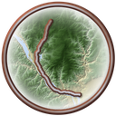
Capital Crescent Trail medallion

RailTrailWx Comfort Scores, for your activity.

Hourly comfort scores for the next 15 days of weather, tuned to your activity and your own thresholds.

Plan your visit to this trail. Get the best windows for a comfortable outing.

View the forecast

Enjoy the Capital Crescent Trail!

Peak Fall Color Climatology

Calendar of the typical peak fall color window along this trail

In half of past years, color along the Capital Crescent Trail peaks November 2 to 9, typically around November 5. The trail has 30% deciduous coverage, with the majority being yellow-poplar, red maple, white oak, chestnut oak, black cherry, and black oak.

History

Coal for a federal heating plant at 29th and K Streets was the last freight the B & O Railroad's Georgetown Branch carried into Georgetown. Crews built part of the branch in 1892. The full line opened in 1910, along with the Roman arch Dalecarlia Tunnel. Below Bethesda, the rails followed Little Falls Branch toward the Potomac. They crossed the Chesapeake and Ohio Canal on the Arizona Avenue Trestle and ran beside the canal into Georgetown. It was a freight line only, hauling mostly coal and building materials. Its customers included the Potomac Electric Power Company, the Washington Mill, and federal buildings. By the 1980s, the General Services Administration was the only customer left. The last train ran in June 1985, after Chessie officials judged one of the bridges unsafe. Advocates moved fast. In 1986 they formed the Coalition for the Capital Crescent Trail and picked the trail's name. Montgomery County bought the Maryland right-of-way in December 1988. In 1990, the National Park Service bought the District section for the C & O Canal National Historical Park. Groundbreaking came on September 30, 1992. The National Park Service paved its section in 1994. Dedication ceremonies opened the full trail in December 1996. In 2017, the section east of Bethesda closed for Purple Line construction.
Trailheads

  • GeorgetownMILE 0Directions
  • Francis Scott Key BridgeMILE 0.7Directions
  • Fletcher's CoveMILE 2.9Directions
  • Little Falls ParkwayMILE 7.1Directions
  • BethesdaMILE 7.7Directions

Connects To

Rock Creek Trail · C & O Canal Towpath: Piedmont

Managed By

C & O Canal National Historical Park and Montgomery Parks

Further Reading

  • Montgomery Parks · Capital Crescent Trail 2.0 Facility Plan
  • Montgomery Parks · Capital Crescent and Georgetown Branch Trails
  • Coalition for the Capital Crescent Trail · History of the Capital Crescent Trail
  • Wikipedia · Capital Crescent Trail
  • Wikipedia · Dalecarlia Tunnel
  • Coalition for the Capital Crescent Trail · Coalition for the Capital Crescent Trail
  • National Park Service · Rehabilitation of the Capital Crescent Trail (CCT)

Nearby trails

Rock Creek Trail medallion

Rock Creek Trail

24 mi·MD, DC
ExploreForecast
Metropolitan Branch Trail medallion

Metropolitan Branch Trail

5.9 mi·DC
ExploreForecast
National Mall Loop medallion

National Mall Loop

6.5 mi·DC
ExploreForecast