RailTrailWx logoRailTrailWx
ForecastExploreLogbookProfilesAboutPricingUpdatesFAQPrivacyTermsYouTube

© 2026 Entrain Weather, LLC. RailTrailWxᵀᴹ and the Entrain Weather Microclimate Engineᵀᴹ are services of Entrain Weather, LLC.

Back to Trail Explorer

Clarion-Little Toby Trail

Clarion-Little Toby Trail, Elk, Jefferson Counties, PA, 18.35 miles

Trail Facts

Length 18 mi
Elevation 1337 to 1443 ft
Grade 0.1% average
Shade cover 72%
Primary surface Crushed gravel
Secondary surface Asphalt

Activities

Biking · Walking · Running · Hiking · Birding · Fishing · Swimming · Cross-country skiing · and more

About This Trail

The Clarion-Little Toby Trail is an 18 mile crushed limestone rail trail between Brockway in Jefferson County and Ridgway in Elk County. It follows Little Toby Creek north from Brockway, then joins the Clarion River for the last miles into Ridgway. Most of the route crosses State Game Lands 44, with no road crossings, no services, and no cell signal between the two towns. Signs mark the lumber era ghost towns of Carrier, Vineyard, Shorts Mill, Blue Rock and Mill Haven, and a swinging footbridge crosses Little Toby Creek at Blue Rock. The grade is rail flat apart from one short hill near Ridgway. Trailheads with parking sit in Ridgway, at Croyland, at Jenkins Run and in Brockway.

RailTrailWx TIPS

Clarion-Little Toby Trail

Your comfort. Prognosticated.

  • The trail is well shaded for nearly its whole length, so the crushed limestone stays damp for a day or more after rain in the deep stretches along Little Toby Creek.
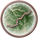
  • The corridor hugs the creek and river bottom under north-south valley walls for most of the way. Thus, the trail gets its sun late in the morning and cools early in the evening.
  • Little Toby Creek and the Clarion River sit in a narrow forested valley that collects cold air overnight, so expect fog along the water and a cold first hour on early starts from either town.
  • The valley runs mainly north and south between Brockway and Ridgway. A south wind pushes you toward Ridgway and a north wind pushes you toward Brockway, while the walls take most of the sting out of a crosswind.
  • The grade is rail flat, with a net drop of about 60 feet from Brockway to Ridgway and one short hill near Ridgway.
  • Most of the trail crosses State Game Lands 44. Wear fluorescent orange during hunting seasons and stay on the trail, and note that e-bikes are not permitted on the game lands.
  • There are no services, restrooms or cell signal for the 18 miles between Ridgway and Brockway. Croyland and Jenkins Run are parking lots only, so carry what you need from town.
  • A 1.8 mile stretch near Ridgway runs beside an active Buffalo and Pittsburgh Railroad line. Stay clear of the tracks.
  • Cross-country skiing is welcomed on the trail in winter. No grooming is advertised, so plan on breaking your own track after fresh snow.
  • While the trail is reasonably well-maintained, the weeds and brush occasionally brush up against the trail, so it is recommended that you use bug spray during the warm months of the year.
  • Go ahead and ride all the way into Ridgway or Brockway. Both towns are handsome and welcoming.

-Cory

Trivia

  • The Blue Rock Swinging Bridge is a 40 foot cable suspension footbridge hung 12 feet above Little Toby Creek, built in 1992 by volunteers from Friends of the Toby and the Future Farmers of America.
  • The swinging bridge stands on the abutments of a 1902 iron bridge that linked the lumber towns of Blue Rock and Ellmont and was scrapped for the war effort in the 1940s.
  • The ruins of the Mill Haven dam near mile 4 date from a mill town founded in 1846; the 1936 flood destroyed the dam.
  • Croyland Trailhead sits on the site of a Civilian Conservation Corps camp that operated from 1933 to 1941.
  • The Clarion River is a designated Wild and Scenic River for 51.7 miles, from the Allegheny National Forest and State Game Lands 44 boundary down to the backwaters of Piney Dam.
  • River otters, beavers, bald eagles and common mergansers work the Clarion River and Little Toby Creek along the trail, and timber rattlesnakes are occasionally seen sunning along the trail.
  • Timber rafted down the Clarion River from this valley reached markets in Pittsburgh and as far away as New Orleans.
  • The first settlers reached the valley in 1798 and Ridgway was founded in 1824.
  • The ghost towns of Carrier lasted from 1854 to 1899 and Vineyard from 1883 to 1895; the marked ghost towns between Croyland and Brockway were all lumber boomtowns that emptied when the timber ran out.
  • The first miles out of Ridgway pass shale cliffs and small waterfalls among stands of mountain laurel and rhododendron.

Climate

Excellent biking days per month, 2011-2025 climatology

In a typical year the Clarion-Little Toby Trail has about 105 to 145 days of excellent weather for popular activities such as hiking, dog walking, e-biking, running, biking, birding, and walking, with May, September, and October the best months.

RailTrailWx Comfort Scores, for your activity.

Hourly comfort scores for the next 15 days of weather, tuned to your activity and your own thresholds.

Plan your visit to this trail. Get the best windows for a comfortable outing.

View the forecast

Enjoy the Clarion-Little Toby Trail!

Peak Fall Color Climatology

Calendar of the typical peak fall color window along this trail

In half of past years, color along the Clarion-Little Toby Trail peaks October 13 to 21, typically around October 17. The trail has 63% deciduous coverage, with the majority being red maple, black cherry, and northern red oak.

History

Log rafts ran down Little Toby Creek and the Clarion River from this valley for decades before any train did. The first settlers arrived in 1798, and Ridgway was founded in 1824. With no roads through the forest, the two waterways were the highway, and the early economy ran on log drives and timber rafting to Pittsburgh and even New Orleans. In 1883 the Pennsylvania Railroad built its Ridgway and Clearfield branch up the valley, from Ridgway through Croyland, Blue Rock and Carrier to Brockwayville, now Brockway. The line served the sawmill towns along the creek: Mill Haven, Grove, Shorts Mill, Blue Rock and Ellmont, Vineyard and Carrier. A quarry and rock crusher at Garovi shipped stone from 1905 to 1929. As the timber gave out, the towns faded one by one, and by 1908 Blue Rock and Ellmont were gone. Penn Central ran the last train in 1968. The tracks came up in 1972. Twenty years later, in 1992, George Miller of Brockway and Dave Love of Ridgway founded the Tricounty Rails to Trails Association to turn the 18 mile right of way into a trail, and the first section opened that same year. Volunteers rebuilt the Blue Rock crossing as a swinging footbridge in 1992. The full trail from Ridgway to Brockway was completed in 2003. The association now works to extend the corridor south to Brookville by way of the Five Bridges Trail and east to DuBois by way of the Wolf Run Trail.

Trailheads

  • BrockwayMILE 0Directions
  • Jenkins Run TrailheadMILE 2.3Directions
  • Croyland TrailheadMILE 9.8Directions
  • Island Run TrailheadMILE 15.7Directions
  • RidgwayMILE 18.4Directions

Connects To

None

Managed By

Tricounty Rails to Trails Association

Further Reading

  • Tricounty Rails to Trails Association · Clarion-Little Toby Trail
  • Tricounty Rails to Trails Association · Clarion-Little Toby Trail Map and Brochure
  • Tricounty Rails to Trails Association · About Us
  • Pennsylvania DCNR · Clarion-Little Toby Creek Trail
  • PA Bucket List · Exploring the Blue Rock Swinging Bridge in Elk County
  • USDA Forest Service · Clarion Wild and Scenic River
  • Uncovering PA · Biking the Little Toby Creek Trail to an Amazing Swinging Bridge

Nearby trails

Five Bridges Trail

8.1 mi·PA
ExploreForecast

Wolf Run Trail

4.2 mi·PA
ExploreForecast

Knox & Kane Rail Trail

31 mi·PA
ExploreForecast