 RailTrailWxRailTrailWx

E-bikingBikingWalkingRunningHikingBirdingand more
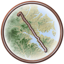
The Broadneck Peninsula Trail is a paved, 10-foot-wide path that runs about 8 miles across the Broadneck Peninsula in Anne Arundel County. It follows College Parkway from Jones Station near Route 2 in Arnold, past Cape Saint Claire and Bay Head Park, to Sandy Point State Park on the Chesapeake Bay. The Severn River lies to the south and the Magothy River to the north. It is a roadside path, not a former rail line, so it rises and falls gently with the land instead of holding a rail grade. Tree cover comes and goes along the parkway. The western end ties into the trail network toward Annapolis and BWI, and the eastern end arrives at the beaches of Sandy Point.
Broadneck Peninsula Trail
Your comfort. Prognosticated.
-Cory

In a typical year the Broadneck Peninsula Trail has about 101 to 148 days of excellent weather for popular activities such as dog walking, hiking, running, e-biking, biking, birding, and walking, with April, May, and October the best months.
Hourly comfort scores for the next 15 days of weather, tuned to your activity and your own thresholds.
Plan your visit to this trail. Get the best windows for a comfortable outing.
Enjoy the Broadneck Peninsula Trail!

In half of past years, color along the Broadneck Peninsula Trail peaks November 6 to 13, typically around November 9. The trail has 26% deciduous coverage, with the majority being sweetgum, yellow-poplar, red maple, and white oak.
Puritans from Virginia settled the Broadneck Peninsula in 1649. They built a scattered hamlet at the mouth of the Severn River and called it Providence. Around 1670 they left it for the harbor at Annapolis. Through the 1700s and 1800s the peninsula stayed rural. Large tobacco and mixed-crop plantations sold their harvests in Annapolis. No railroad ever ran this route. The trail follows the right of way of College Parkway, the road that crosses the peninsula past Anne Arundel Community College. Residents wrote the idea into the county's Small Area Plans in 1999. The county broke ground on the first phase in August 2012. Planners then described a 6.6 mile path linking the B & A Trail in Arnold to Sandy Point State Park. The work came in five phases, each funded on its own with federal and state grants and county capital money. For years the open pieces ended at road crossings. A federal award later paid for about 2.5 miles between Peninsula Farm Road and Bay Dale Drive. A Maryland Bikeways grant carried the path about another mile to Bay Head Park. On March 30, 2026, the county cut the ribbon on the last three phases, one of them with new bridges. For the first time, the trail ran as one unbroken route of close to 8 miles, from Route 2 to Sandy Point. The county thanked Ed Parker, a Friends group board member whose donations paid for added amenities.