RailTrailWx logoRailTrailWx
ForecastExploreLogbookProfilesAboutPricingUpdatesFAQPrivacyTermsYouTube

© 2026 Entrain Weather, LLC. RailTrailWxᵀᴹ and the Entrain Weather Microclimate Engineᵀᴹ are services of Entrain Weather, LLC.

Back to Trail Explorer

B & A Trail

B & A Trail, Anne Arundel County, MD, 16.48 miles

Trail Facts

Length 16 mi
Elevation 41 to 123 ft
Grade 0.2% average
Shade cover 50%
Surface Asphalt

Activities

E-biking · Biking · Walking · Running · Birding · Fishing · and more

About This Trail

The B & A Trail is a paved rail trail on the old Baltimore and Annapolis Railroad grade through Anne Arundel County. It starts at Boulters Way on the edge of Annapolis. From there it runs north-northwest through Severna Park, Harundale, and Glen Burnie to the BWI Trail loop around the airport. This is a community trail, lined by neighborhoods, small parks, and wooded strips. The grade is nearly flat the whole way. Along the route you pass the Earleigh Heights Ranger Station, the Cattail Creek Natural Area, the Planet Walk with its displays for the sun and each planet, and a series of lettered historical markers. The trail is open from dawn to dusk.

RailTrailWx TIPS

B & A Trail

Your comfort. Prognosticated.

  • The trail runs almost straight north-northwest from Annapolis to Glen Burnie. A south or southeast wind pushes you along northbound and meets you head on coming back, and a northwest wind does the reverse.
  • Almost the whole route sits on flat ground or low fill, with only a few short cuts. The terrain gives little shelter, so wind reaches the trail wherever the tree line thins.
  • Shade comes and goes. Wooded strips alternate with sunnier stretches past neighborhoods and shopping centers, so expect patchy sun rather than long shaded tunnels or long exposed runs.
  • The two ends sit at nearly the same height, and the climb end to end is small.
  • The paved surface sheds water faster than a gravel trail, so the B & A is a good pick soon after rain.
  • The trail is open from dawn to dusk only, so short winter days shorten the window for an evening outing.
  • The Annapolis end runs a little cooler on hot summer days when a sea breeze kicks in from the Chesapeake Bay.

-Cory

Trivia

  • The Earleigh Heights Ranger Station in Severna Park was built in 1889 as a general store known as Frost's Store.
  • The Planet Walk along the trail is a linear museum with a display for the sun and each planet.
  • Historical markers lettered A to Z line the trail, designed and placed as an Eagle Scout service project.
  • Old railroad switch boxes and sections of track still stand beside the trail.
  • In June 1996 the trail became part of the East Coast Greenway.
  • The whole trail is a linear park of 112 acres winding through parks, neighborhoods, and wooded areas.

Climate

Excellent biking days per month, 2011-2025 climatology

In a typical year the B & A Trail has about 105 to 155 days of excellent weather for popular activities such as hiking, dog walking, running, e-biking, birding, biking, and walking, with April, May, and October the best months.
RailTrailWx Comfort Scores, for your activity.

Hourly comfort scores for the next 15 days of weather, tuned to your activity and your own thresholds.

Plan your visit to this trail. Get the best windows for a comfortable outing.

View the forecast

Enjoy the B & A Trail!

Peak Fall Color Climatology

Calendar of the typical peak fall color window along this trail

In half of past years, color along the B & A Trail peaks November 4 to 12, typically around November 8. The trail has 32% deciduous coverage, with the majority being yellow-poplar, sweetgum, and red maple.

History

Steam trains of the Annapolis and Baltimore Short Line first ran this grade in 1887. New England promoters had chartered the company in 1880. Near Annapolis, the trains crossed the Severn River on a long timber trestle. In 1908 the line was electrified. It took a new name, the Maryland Electric Railways Company. The Washington, Baltimore and Annapolis bought it in 1921. That company failed in 1935, and the line went quiet. Bondholders bought it back that August and reorganized it as the Baltimore and Annapolis Railroad. Electric cars carried passengers until February 1950. After that, buses carried the passengers and the rails carried freight. Freight stopped reaching Annapolis in 1968, when the trestle over the Severn River went out of service. A year later the Marley Creek Bridge was damaged, and trains stopped running south of Glen Burnie. In 1972 Tropical Storm Agnes washed out the Patapsco River bridge, and all service on the line ended. Maryland passed a law in 1974 asking that the corridor become a trail. Anne Arundel County bought the 66-foot-wide strip in 1979. Crews built the trail in five phases, starting with a mile in Glen Burnie from Dorsey Road to the courthouse. The final phase was finished in October 1990. The trail opened on October 7, 1990, as the second rail trail in Maryland.
Trailheads

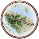
  • AnnapolisMILE 0Directions
  • Boulters Way TrailheadMILE 1.3Directions
  • Jones StationMILE 5.3Directions
  • Severna ParkMILE 6.7Directions
  • B & A HeadquartersMILE 9Directions
  • HarundaleMILE 13.7Directions
  • Glen BurnieMILE 14.8Directions
  • Sawmill Creek ParkMILE 15.6Directions

Connects To

BWI Trail

Managed By

Anne Arundel County Recreation and Parks

Further Reading

  • Wikipedia · Baltimore & Annapolis Trail
  • Maryland Department of Natural Resources · Baltimore & Annapolis Trail
  • Wikipedia · Baltimore and Annapolis Railroad
  • Baltimore & Annapolis Railroad Overview

Nearby trails

Broadneck Peninsula Trail

8.1 mi·MD
ExploreForecast

BWI Trail

11 mi·MD
ExploreForecast

WB & A Trail

13 mi·MD
ExploreForecast