RailTrailWx logoRailTrailWx
ForecastExploreLogbookProfilesAboutPricingUpdatesFAQPrivacyTermsYouTube

© 2026 Entrain Weather, LLC. RailTrailWxᵀᴹ and the Entrain Weather Microclimate Engineᵀᴹ are services of Entrain Weather, LLC.

Back to Trail Explorer

Assateague Island Bike Path

Assateague Island Bike Path, Worcester County, MD, 4.75 miles

Trail Facts

Length 4.8 mi
Elevation 4 to 6 ft
Grade 0.0% average
Shade cover 3%
Surface Asphalt

Activities

E-biking · Biking · Walking · Running · Hiking · Birding · Fishing · Swimming · and more

About This Trail

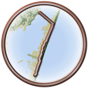
The Assateague Island Bike Path is a paved path of almost five miles. It links the National Park Service visitor center on the Maryland mainland with the Maryland district of Assateague Island National Seashore. The path crosses Sinepuxent Bay on its own bridge beside the Verrazano Bridge. It passes the entrance to Assateague State Park, then follows Bayberry Drive south behind the dunes, separated from the road the whole way. The grade is dead flat. Three short nature trails open off the route, through salt marsh, maritime forest, and dunes, and visitors leave bicycles at each trailhead to walk them. Wild horses often wander near the road.

RailTrailWx TIPS

Assateague Island Bike Path

Your comfort. Prognosticated.

  • There is almost no shade from the visitor center to the dunes. The path crosses open marsh and low dune grass, so sun and wind impact you the whole way.
  • The path runs roughly north to south down the island. Heading out toward the dunes, a north wind is at your back and becomes a headwind on the return to the mainland; a south wind does the reverse.
  • The island is flat and sits only a few feet above Sinepuxent Bay, with nothing taller than the dunes to break the wind. A crosswind off the ocean or the bay hits at full strength.
  • The bridge over Sinepuxent Bay is the only rise on the route and its most exposed spot. An observation platform at the crest is a good place to take in the view and judge the wind before you head onto the island.
  • The only real woods are at the Life of the Forest Trail, where a maritime forest of loblolly pine grows behind the dunes.
  • Bicycles are not allowed on the Life of the Marsh, Life of the Forest, or Life of the Dunes trails. Lock up at each trailhead and walk them.
  • This is an ocean-side path, so expect temperatures to be heavily moderated by the surrounding waters. Compared to inland, it'll be cooler on summer afternoons and warmer on winter days.

-Cory

Trivia

  • Assateague Island is about 37 miles long, yet it is never more than a mile wide.
  • The United States Life-Saving Service ran four stations on Assateague from 1875 until 1915.
  • A twisted loblolly pine on the Life of the Forest Trail began growing when the site was still open duneland.
  • The high ocean foredune that now shelters young pines was first built by developers in the 1950s.
  • Until the mid 1970s, part of the Life of the Forest Trail crossed a freshwater cattail marsh that common reed has since taken over.
  • In the sheltered heart of the maritime forest, wax myrtles grow into small trees more than 20 feet tall.
  • The great horned owl sits at the top of the food chain in the Assateague forest.
  • The bicycle and pedestrian bridge over Sinepuxent Bay has an observation platform at its crest that overlooks the boating channel.

Climate

Excellent biking days per month, 2011-2025 climatology

In a typical year the Assateague Island Bike Path has about 81 to 136 days of excellent weather for popular activities such as hiking, dog walking, running, e-biking, biking, birding, and walking, with April, May, and October the best months.
RailTrailWx Comfort Scores, for your activity.

Hourly comfort scores for the next 15 days of weather, tuned to your activity and your own thresholds.

Plan your visit to this trail. Get the best windows for a comfortable outing.

View the forecast

Enjoy the Assateague Island Bike Path!

Peak Fall Color Climatology

There is too little deciduous tree cover along the Assateague Island Bike Path to measure a peak color window. The trail has 3% deciduous coverage, with the majority being red maple, sweetgum, and American holly.

History

Ferries carried visitors to the Maryland end of Assateague until the Verrazano Bridge opened in 1964. The island had taken its present shape three decades earlier. In August 1933, a storm cut an inlet at Ocean City and split Assateague from the land to the north. In the 1950s, developers platted a resort town called Ocean Beach on the Maryland side. They sold lots and paved Baltimore Boulevard as its main street. They also built up a high foredune along the ocean. The Ash Wednesday Storm of 1962 wrecked the few buildings and roads. The damage showed the island was too unstable for a town, and the federal government bought the land. Maryland had already set aside Assateague State Park in 1956, and the state still runs two miles of the island. President Lyndon B. Johnson signed the law creating Assateague Island National Seashore on September 21, 1965. No railroad ever ran here. The path follows the park roads instead. A safety study later found that walkers and cyclists needed their own crossing of Sinepuxent Bay. A separate bridge was built beside the Verrazano Bridge, and it won a federal Excellence in Highway Design award in 1998. A piece of old Baltimore Boulevard still lies along the Life of the Dunes Trail at the path's southern end.

Trailheads

  • Assateague Island Visitor CenterMILE 0Directions
  • Assateague State ParkMILE 1.3Directions
  • Life of the Marsh TrailMILE 3.6Directions
  • Life of the Forest TrailMILE 4.1Directions
  • Life of the Dunes TrailMILE 4.8Directions

Connects To

Life of the Marsh Trail · Life of the Forest Trail · Life of the Dunes Trail

Managed By

National Park Service

Further Reading

  • National Park Service · Take a Bike Ride
  • National Park Service · Assateague Island National Seashore Reopens Life of the Marsh and Life of the Forest Trails and Changes Speed Limits
  • National Park Service · History and Culture
  • Wikipedia · Assateague Island National Seashore
  • Federal Highway Administration · Assateague Island Bicycle and Pedestrian Bridge, Excellence in Highway Design 1998
  • National Park Service · The Life of the Forest Nature Trail
  • Visit Maryland's Coast · Spend Time Biking Along Maryland's Coast This Season
  • Wikipedia · Verrazano Bridge (Maryland)

Nearby trails

Terrapin Run Trail

4.5 mi·MD
ExploreForecast

Easton Rail Trail

2.8 mi·MD
ExploreForecast

Cross Island Trail

6.4 mi·MD
ExploreForecast